| DISTINCTIVE VIEWS of OUR BEAUTIFUL WORLD |
| Home Art Covered Bridges Lighthouses Military Pirates Railroads SHIPWRECKS |
|
NATIONAL GEOGRAPHIC SHIPWRECK MAPS Three maps locate thousands of Atlantic coast wrecks from the 17th thru 20th centuries; plus lighthouses, navigational beacons, lifesaving stations and coastal features. With insets, sidebars and photographs. Size: 28"x36".
NORTHEAST –
Maine, New Hampshire, Massachusetts & Rhode
Island |
 |
|
|
 |
|
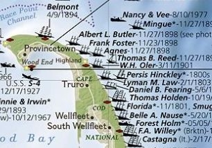
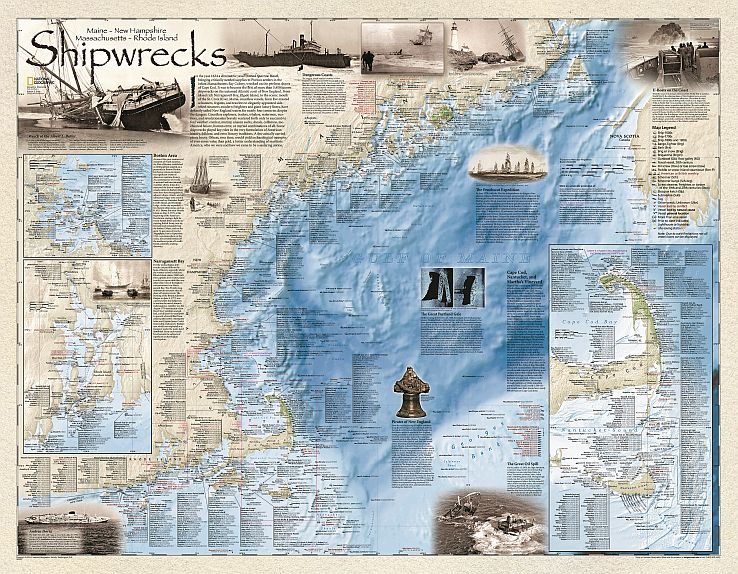
Shipwrecks of the Northeast Maine to Rhode Island, with insets for Nantucket Sound, Cape Cod Bay, Martha's Vineyard, Narragansett Bay & Boston Harbor Islands. Features include Pirates of New England, The Great Portland Gale and Wreck of the Albert L. Butler.
|
|
FLAT PAPER MAP Rolled in polysleeve Retail price $19.99 |
|
|
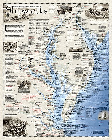 |
Shipwrecks of DelMarVa The Delaware coast to Chesapeake Bay. Features include The Ghost Fleet of Mallow Bay and the 1814 burning of Washington, D.C.
FOLDED PAPER MAP
FLAT PAPER MAP
LAMINATED POSTER |
|
|
|
P.O. Box 731, Rhinebeck, NY 12572 • tel 845-758-1460 • fax 866-954-6119 • sales@bellaterramaps.com Copyright © 2025. Bella Terra® is a registered trademark of Bella Terra Publishing, LLC |