| DISTINCTIVE VIEWS of OUR BEAUTIFUL WORLD |
| Home Art Covered Bridges LIGHTHOUSES Military Pirates Railroads Shipwrecks |
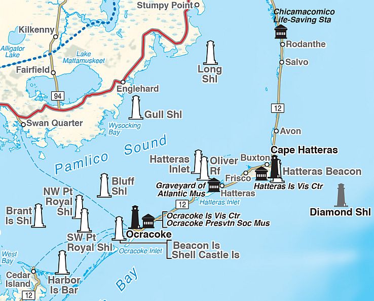
 Bella Terra's state & regional lighthouse maps are a unique combination of map, guidebook & souvenir. Most titles are available as a folded map or laminated poster.
The cartography makes it easy to spot lighthouse locations. And the guides take you right there, with well-researched histories and viewing directions.
Beautiful original watercolor illustrations make these maps delightful keepsakes. Many of the images are available as notecards, matted prints and magnets; see Art.
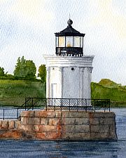
Above: Detail of Portland Breakwater Light, © Rob Thorpe, from Maine Lighthouses. |
 |
California & Hawaii Includes Lake Havasu (CA-AZ)
Maine
Mid-Atlantic
Northwest
Southeast
United States |
 | ||
|
P.O. Box 731, Rhinebeck, NY 12572 • tel 845-758-1460 • fax 866-954-6119 • sales@bellaterramaps.com Copyright © 2025. Bella Terra® is a registered trademark of Bella Terra Publishing, LLC |